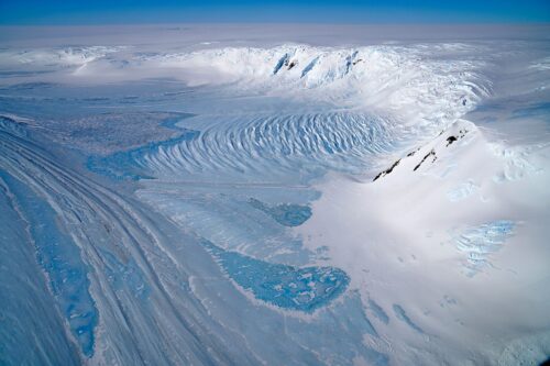
When one thinks of Antarctica, the first image that comes to mind is a wide-open, stark white, snow-covered plain stretching out as far as the eye can see. However, one of the most important features of the Antarctic landscape is strikingly different from this image. Blue-ice areas (BIAs) are expansive regions of exposed ice, named for their vibrant azure color. Despite making up a relatively small proportion of the continent’s land area, their scientific worth is immense: BIAs trap valuable meteorites, increase the rate at which the Antarctic ice sheet melts, and contain extremely old ice that can be used to understand the history of Earth’s climate.
At first glance, given the size of Antarctica, locating all of the BIAs across the continent is an enormously challenging, if not impossible, task. However, thanks to a clever application of machine learning technology, a team led by glaciologist Veronica Tollenaar at Université libre de Bruxelles has done exactly that in their recent paper. Previous methods to find BIAs in Antarctica involved analyzing the colors of light bounced back to satellites, leading to significant errors when checked manually. One reason for this is that prior models were unable to differentiate between temporary snow cover and long-lasting snow cover, a critical distinction to make when determining if a location is a BIA.
To address these inaccuracies, the researchers implemented a convolutional neural network, a program designed to process data through multiple layers of filters. The method simulates how the human brain perceives and interprets visual information by recognizing patterns and features of images. The researchers provided the neural network with inaccurate maps produced using classical methods, as well as a smaller number of maps that had these errors removed by hand. The model then used the information from the “clean” maps to detect the mistakes in the inaccurate ones. “Because we are using deep learning, [we] are able to abstract the immediate data, take special context into account, and make sure that we learn something that is more than a simple optical difference,” said Benjamin Kellenberger, a postdoctoral researcher at Yale and a co-author of the study. The results substantiated Kellenberger’s statement: performing a detailed analysis of the reflection spectrum of areas where the original and new maps disagreed revealed that the new maps reduce cases where blue ice was missed or falsely identified. “It really has to do with scaling up of properties that we measure,’” Kellenberger said.
This work emphasizes the advantage of using machine learning models in this area of research. Given the monumental scale of Antarctica itself, the union of geophysical and computational science applied in this study may offer key insights into future efforts to map the history of our planet.
Image courtesy of Wikimedia Commons.

